Utah Red Rock Country: Capitol Reef National Park
Meghann Maurer, May 29, 2015
After exploring Canyonlands and Arches National Parks a year ago, a group of friends and I decided to venture further into Utah’s red rock country and explore the 100-mile long Waterpocket Fold that makes up Capitol Reef National Park. Just 2 hours southwest beyond the Moab exit, Capitol Reef is the perfect place for those looking for new terrain to explore and views of the stunning desert landscape.
Situated in the heart of Utah, Capitol Reef is not only an adventurer’s playground but also rich in cultural, biological, and geological history. The Fremont River runs perpendicular to the length of the park, cutting through colorful sandstone, and culminating in a lush and protected oasis, known as the Fremont River Valley, the historical town of Fruita, and the present day site of the park’s visitor center. Petroglyph’s decorate canyon walls left by archaic native peoples and vast orchards surround the historical building sites of early Mormon pioneers.
While Capitol Reef’s big name National Park neighbors like Arches and Canyonlands to the east and Zion and Bryce Canyon to the southwest are spectacular in their own right, they often get more publicity and attract larger crowds. Thus, if you’re looking to avoid a frenzy of tourists, Capitol Reef is a great option.

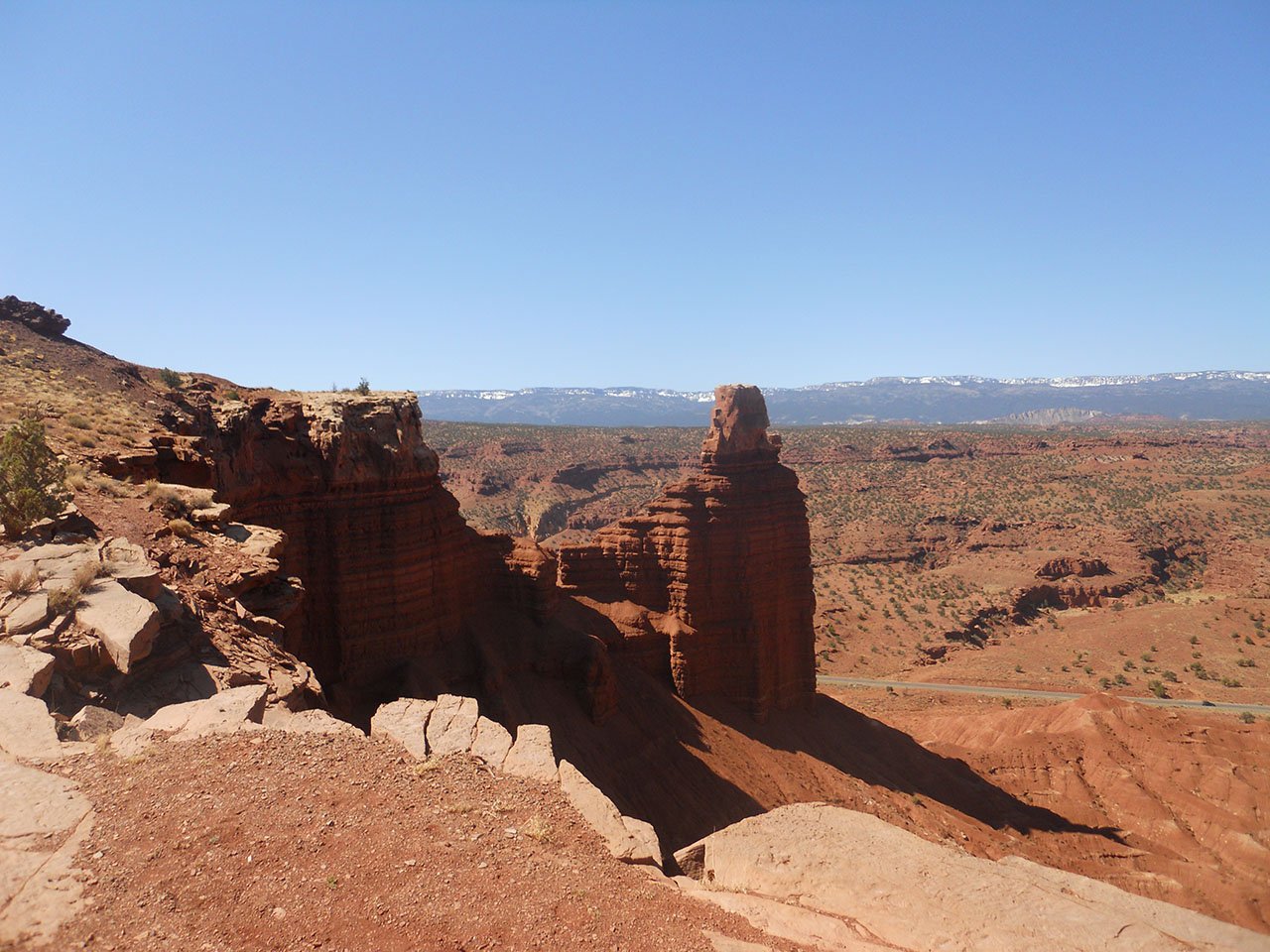
Capitol Reef offers plenty of terrain for backpacking, rock climbing, biking, and horseback riding, although hiking is perhaps the easiest way to quickly immerse yourself into the spectacular desert environment. None of the hikes are especially hard or long, which makes it perfect for a varied activity-filled trip. Cassidy Arch Trail, a 3.5 mile round trip starts at the Grand Wash Road parking lots and weaves its way up the sheer cliff walls. As you gain elevation, you also gain 360-degree views. The trail eventually ends at Cassidy Arch. The arch is plenty wide enough to walk across, although an 800-foot drop lies on either side. Chimney Rock Loop Trail (3.5 RT) was another particular favorite. The hike starts out steep and then becomes increasingly gradual as you climb your way onto a large butte for views of Chimney Rock and the park’s expanse to the south. Golden Throne, Hickman Bridge, and Grand Wash are other hikes definitely worth the mileage. Consult the full list of trails for more options.
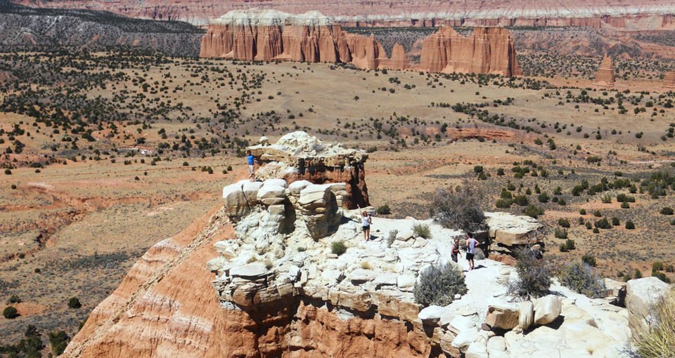
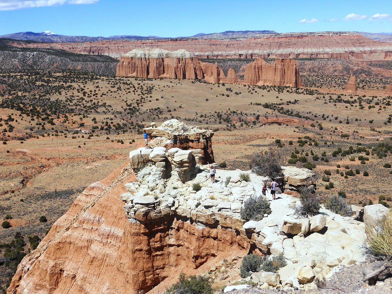
Because of Capitol Reef’s difficult terrain and sheer size, exploring the full length of the Waterpocket fold requires embarking on a couple of road tours. My group opted for the Cathedral Valley District tour in the northern vicinity of the park. For 59 miles this tour leads you through an ever-changing landscape. One stop along the way leads you through an area composed of colorful bentonite clay. It’s vivid appearance and texture will alone make you feel as though you are on another planet entirely. As you drive deeper into the northern half of the Waterpocket Fold you will encounter stunning vistas of deep valleys and sandstone monoliths that jut sharply out of the ground. This drive makes for a good day trip or gives you access to a number of primitive campsites. Additionally, this tour requires crossing the Fremont River, so make sure you have have a vehicle with high clearance and check water levels before you go. The Waterpocket District tour explores the southern portion of Capitol Reef.
When to go
Like other high desert areas in Utah, Spring (April-May) and Fall (mid-September-October) are the best months to visit. These months offer the most comfortable day and nighttime temperatures. During the summer, the possibility of afternoon thunderstorms and flash floods increases significantly and temperatures often exceed 100 F.
Getting to Capitol Reef National Park
Heading west on I-70 take exit 149 to UT-24 west and travel approximately 43.8 miles to the town of Hanksville. Turn right to stay on UT-24 and continue another 47.3 miles to the Capitol Reef National Park Visitor Center and the historic town of Fruita.
Accommodation
From the visitor center, take Campground Road/Scenic Drive to the Fruita Campground. Camping here is first come, first serve (71 spots available) with a $10 fee per night. Despite convenient access to restroom facilities and water, campsites are very close to one another.
The park also offers primitive campsites without fees or resercations in the Cathedral Valley campground area (36 miles from visitor center) and Cedar Mesa campground area (23 miles from visitor center).
Just a few miles west of the entrance to the park there is a scattering of unofficial campsites off of UT-24 without fees or reservations. This area is part of Fishlake National Forest. On the north side of the highway, between mile markers 73 and 74, turn off onto a dirt road to access several campsites with fire rings. Some spots are big enough to fit RVs and/or rigs and there is plenty of flat ground to stake your tent (if the ground is soft enough). My group opted for a spot furthest from the highway and found it’s seclusion and unobstructed sky far preferable to the Fruita campground. Hike up to the top of any of the surrounding ridges for spectacular views of the park to the south, and the outskirts of the city of Torrey to the west.
For those not interested in roughing-it, the city of Torrey is 11 miles west of the park entrance, complete with hotels and restaurants, though lacking in natural majesty.
Useful Information
- There is a $3.00 individual fee (bicycles or pedestrian) or $5.00 vehicle fee (both good for 7 days) to access the park’s Scenic Drive
- Backcountry permits are required for backpacking and can be obtained at the visitor center.
- If you are interested in backpacking check out Capitol Reef’s backcountry options.
- See review of Moab’s Fiery Furnace for more Utah red rock adventures.
- Capitol Reef National Park latest news (fees, hours…)